
13 Ways to Get Your Summer Thrills in Tasmania
Make the most of the longer days this summer with adrenaline-fueled adventures and nature-rich experiences, right on your doorstep.
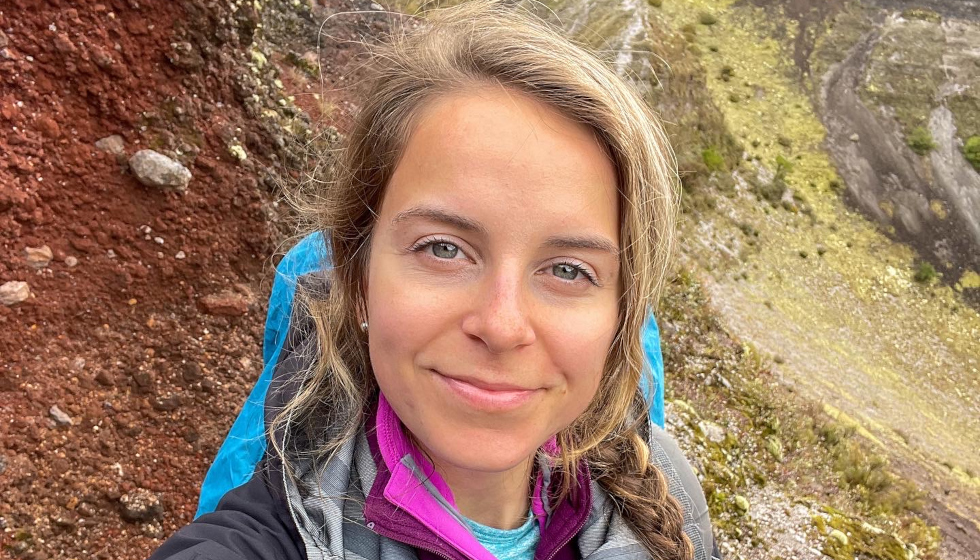
Dr Hannah Moore is a Scottish volcanologist who works from Tasmania. Next month she’s leading a tour of the Tasman Peninsula as part of the upcoming Beaker Street Festival.
Where did your interest in volcanology first start?
I grew up in Edinburgh, a city quite literally built around volcanoes. Arthur’s Seat, looming over the skyline, is an extinct volcano. Edinburgh Castle is perched on Castle Rock – an ancient volcanic plug, the hardened throat of a volcano left standing after all the softer rocks around it eroded away. You can’t grow up in Scotland without geology quietly working its way into your head, whether you notice it happening or not. So, in a sense, volcanoes shaped my world long before I ever studied them properly – I just didn’t know at the time.
What hooked me later was realising that volcanoes sit at this intersection of the most exciting and most dangerous parts of geology – they’re forces capable of reshaping landscapes overnight, but they’re also one of the most threatening natural hazards on the planet. I wanted to understand why volcanoes behave the way they do; what’s actually happening beneath the surface before they erupt, and how that understanding can be turned into something useful – into earlier warnings, better risk assessments, fewer disasters. That curiosity eventually took me a long way from Edinburgh. My PhD took me here to Tasmania, while my study site was a volcano in Aotearoa/ New Zealand.
I know Tasmania seems like an unusual place for a volcanologist to end up, but we actually have world-renowned researchers here at the University of Tasmania, particularly in submarine volcanology. Ancient volcanism is also the backbone of Tasmania’s mining industry, so there’s always a need for people who understand volcanic processes and the deposits they leave behind.
Tasmania was once part of Antarctica. What physical evidence of that breakup can still be seen in the landscape today?
You can read the whole story in the rocks under your feet. Around 300 million years ago (the Permian period), Tasmania was part of the supercontinent Gondwana and sat very close to the south pole. Parts of it would have looked a lot like Antarctica does now: ice sheets, glaciers, icebergs drifting through shallow seas. Some of the rocks formed at that time in Tasmania contain dropstones, isolated rocks that literally fell out of melting icebergs into soft seafloor mud. We also share fossils with Antarctica from this period – marine shellfish like Eurydesma, and the seed-fern forests of Glossopteris – some of the strongest physical proof these continents were once joined.
Then, around 250 million years ago (Triassic), the climate began to warm, the ice retreated, and lush Gondwanan forests spread across the river plains, even at Tasmania’s high southern latitude. We see seed ferns from this time (Triassic period) like the Dicroidium in the rocks in both Tasmania and Antarctica, suggesting the two were both still connected.
The real upheaval came in the Jurassic period about 180 million years ago, when Gondwana began tearing itself apart. Enormous volumes of magma surged up through the stretching crust. The same event left dolerite and basalt scattered across Tasmania, Antarctica, New Zealand, southern Africa and Argentina. Here, very little of that magma erupted; it pushed sideways between rock layers and cooled underground, some intrusions over a kilometre thick. That single event is why Tasmania is arguably the dolerite capital of the world – hundreds of dolerite mountains, a third of our landscape capped in it, and not one dolerite mountain on the mainland. It built the cliffs of the Tasman Peninsula, the flat-topped Central Plateau, the skyline of Kunanyi/ Mt Wellington.
Tasmania didn’t actually separate from Antarctica until much later – about 45 million years ago; prised apart by a spreading ridge that pushed Australia north while Antarctica stayed locked at the pole. They were some of the last pieces of Gondwana to let go of each other, which is part of why our geology still has more in common with Antarctica than with mainland Australia.
What’s the most significant volcanic event in Tasmania’s geological history, and how did it shape the island we know now?
People usually assume I’ll say the Jurassic igneous event I just mentioned, and it’s a contender, but for me it’s the Mount Read Volcanics on the west coast of Tasmania. These volcanic rocks formed half a billion years ago in the Cambrian period. At that point, Tasmania sat beside a major subduction zone on the edge of Gondwana. The ongoing tectonic forces stretched and thinned the crust, allowing heat and magma to rise through it and triggering millions of years of submarine volcanism across western Tasmania. Those eruptions built the foundations for some of Tasmania’s most important mineral deposits and shaped both the geology and history of the west coast.

Stay up to date with everything happening at the Hobart Magazine.